3D geological model of the Lublin Basin is the first step of the continuous programme of of 3D modelling of Poland's main sedimentary basins run by Polish Geological Survey (PSG). It is a methodical challenge in the light of the achievements in this field both in Poland and other countries, especially due to the huge data resource used in the model. So far, similar solutions have been applied on a regional scale only in few studies and only in relation to selected stratigraphic units, perspective for hydrocarbons and geothermal resources.
The main goal of the project was to create a spatial, numerical 3D model of the deep geological structure of the Lublin Basin and to develop methods for its visualization using, among others, web browsers.
The model of the Lublin Basin is available in the web-viewer of the Polish Geological Institute - National Research Institute. It provides, among others, spatial interpretation of geological information archived so far in the databases and cartographic materials. The advantage of the model is the possibility of its continuous modification and upgrading by refining of mesh and supplementing with new information (eg rock parameters) along with the inflow of new data. Additionally, after completing the model with set of rock properties, it can be the basis for various geophysical, hydrogeological or deposit dynamic simulations.
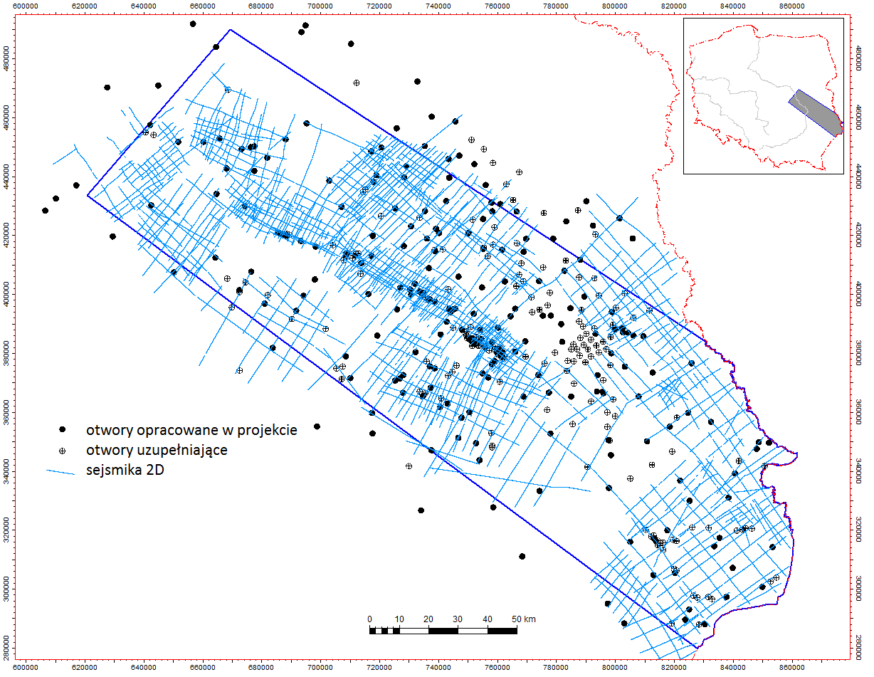
Figure 1. Map of the research area with the location of boreholes and 2D seismic profiles used to build the model below the Cenozoic.
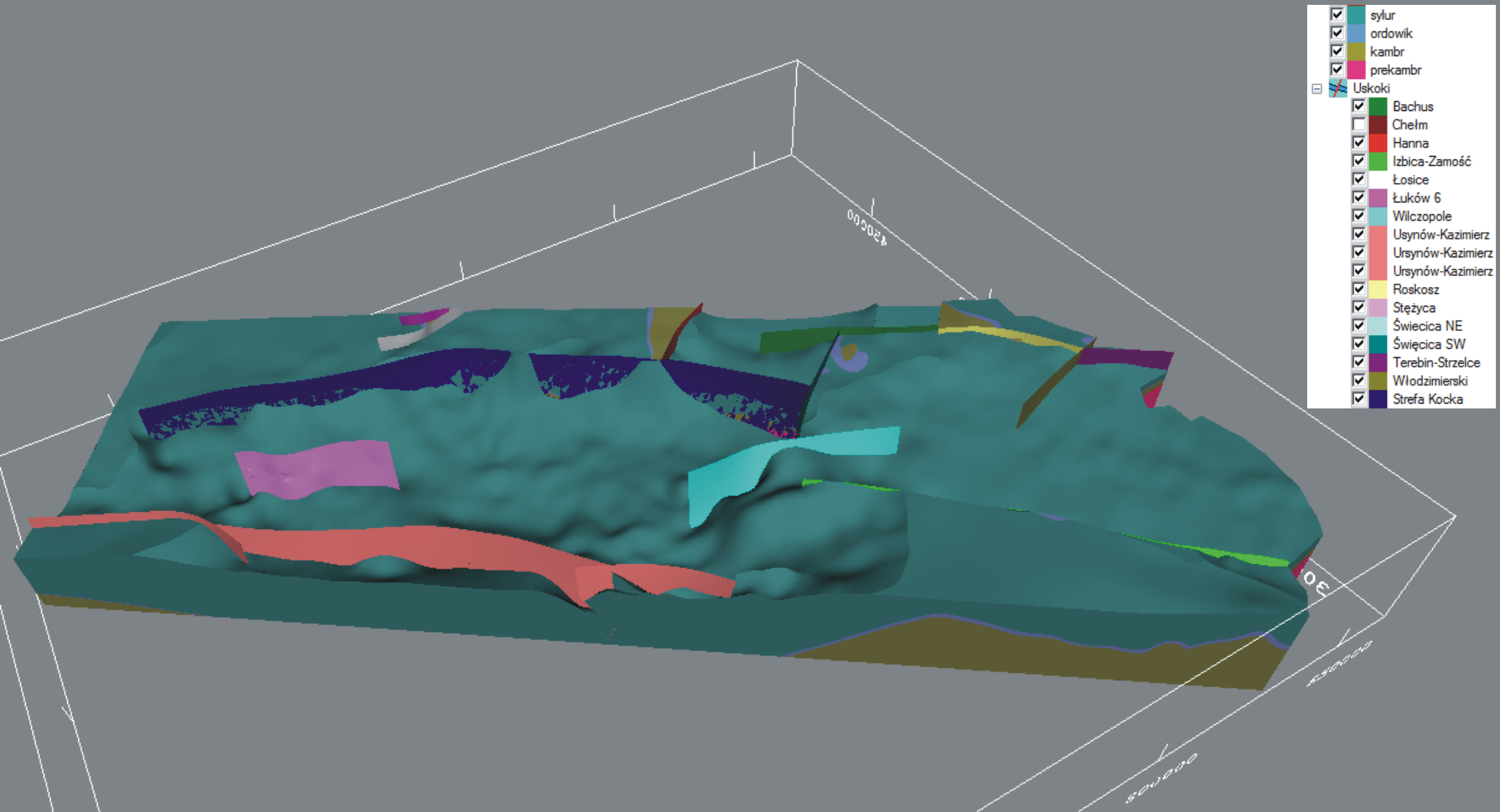
Figure 2. A view of the structural model of the Lublin Basin, containing all major faults and the lowest structural horizons –Pre-Cambrian, Cambrian, Ordovician and Silurian.
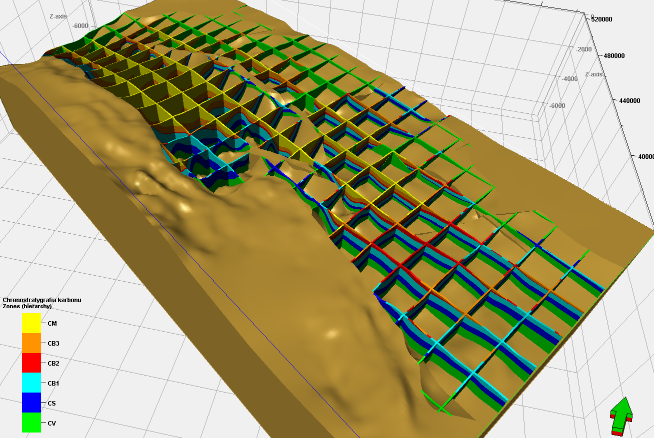
Figure 3. Modelling of chronostratigraphy (grid 3D) on the example of the Carboniferous model. The standard colours of Carboniferous have been changed in order to better illustrate the separated units. Visualization on the bedrock. Vertical exaggeration x 10.
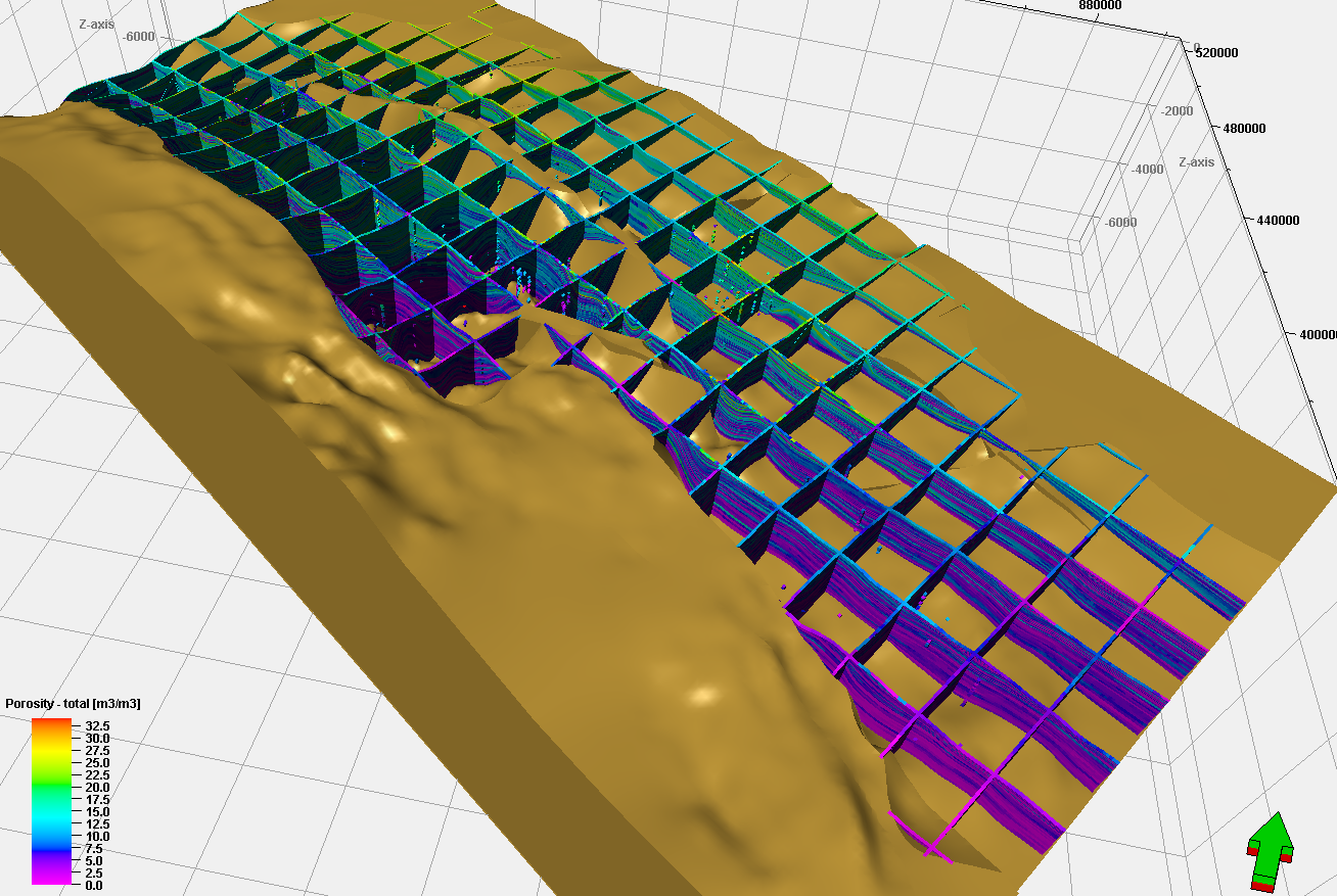
Figure 4. Modelling of reservoir parameters, on the example of a model of total porosity in carbon. Visualization on the bedrock. Vertical exaggeration x 10.
The study was prepared on the request of the Minister of the Environment and financed by the National Fund for Environmental Protection and Water Management. Contract No. 64/2013 / Wn-07 / FG-BP-DN / D of 21/02/2013 pursuant to the Act dated. April 27, 2001, Environmental Protection Law and resolutions of the Management Board of NFOŚiGW dated 27/12/2012 No. B / 62/14/2012 and resolutions of the Supervisory Board of NFOŚiGW dated 08/01/2013 No. 2/13. The initiative regarding the visualization of sedimentary basins in Poland is one of the elements of the Resort Policy in the field of geological mapping (for the years 2008-2015) in item 3.3.1 - Development of deep digital 3D models of the main Polish basin structures - as the first 3D model of the Lublin Basin.